Annual Beaver Lake Volunteer Day Event: September 29th, 2025 Register Now
Home » Watershed Plans » Upper White River Watershed Management Plan
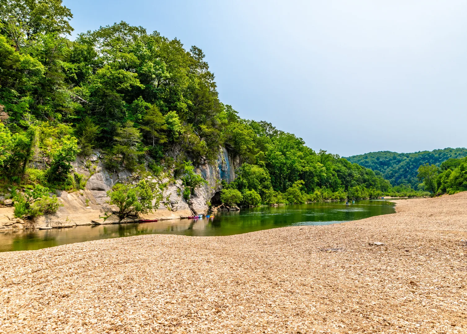
Spanning Northwest Arkansas (NWA) and Southern Missouri, the Upper White River Watershed is one of the region’s most important resources. On the Arkansas side, it includes Beaver Lake, which supplies drinking water for over 500,000 people in NWA, but also many of our most beloved waterways such as the White River, War Eagle Creek, Kings River, West Fork White River, Long Creek, and over 2,700 miles of streams. The Upper White River watershed is the source of many critical wildlife habitats, natural scenic areas, and a wide variety of recreational uses.
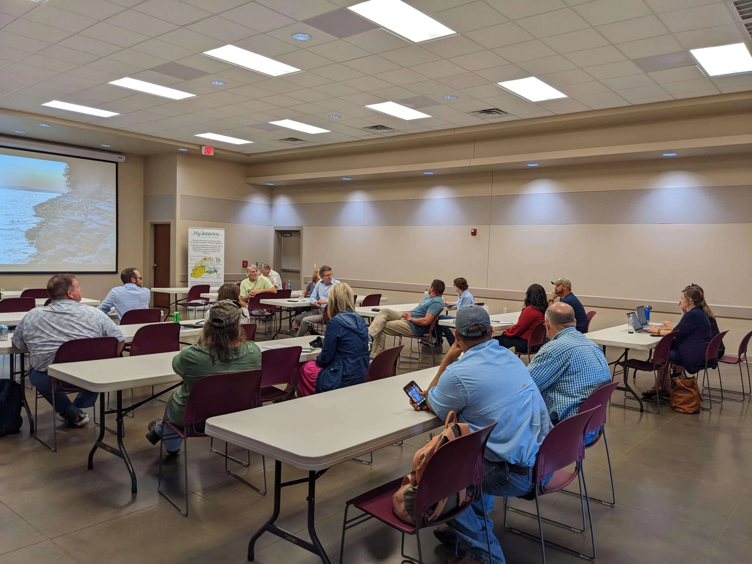
This Watershed Management Plan developed for the Arkansas side of the watershed, is a community-driven roadmap for protecting and restoring local water quality. Developed with extensive stakeholder input and aligned with EPA’s nine key elements, this voluntary plan identifies where and how to focus resources to reduce pollution, protect drinking water, support aquatic life, and safeguard recreational use.
Explore our priority subwatersheds, the voluntary practices we’re promoting, and how you can be part of the effort to keep the Upper White River healthy for generations to come. Learn more about watershed management plans and what they do
Note that this project was made possible through a grant from the Arkansas Department of Agriculture Natural Resources Division supported by the U.S. Environmental Protection Agency’s 319 Program for Non-Point Source Pollution Control.
Plan Completed: July, 2025
Stakeholders Engaged: 89, with representatives from 26 groups
Subwatersheds Assessed: 69 HUC12 subwatersheds
Miles of Streams and Rivers: 2,700
Impaired Waterways: 135 miles of streams + 3,400 acres of Beaver Lake
Pollutants of Concern: nutrients, sediment, total dissolved solids, sulfate, bacteria, pH, temperature, dissolved oxygen
Sources of Concern: Runoff from pasture, developed areas, livestock operations; failing septic systems; unpaved roads; streambank erosion

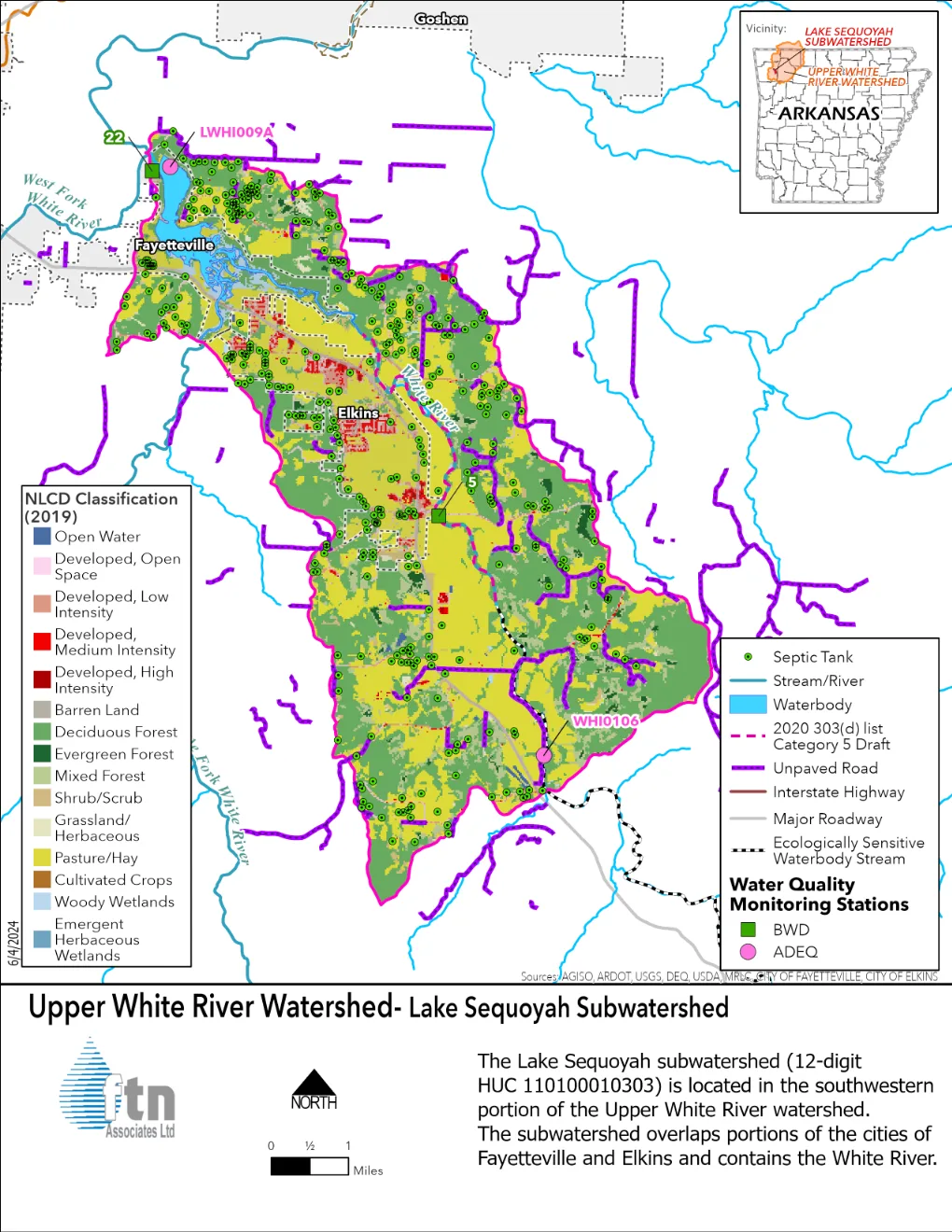
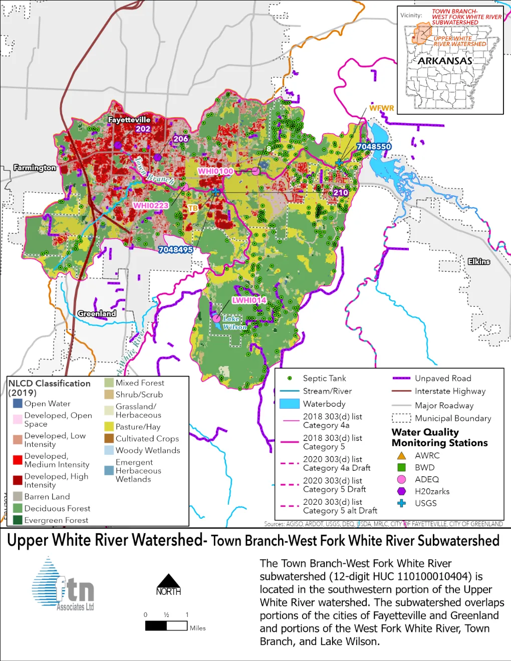
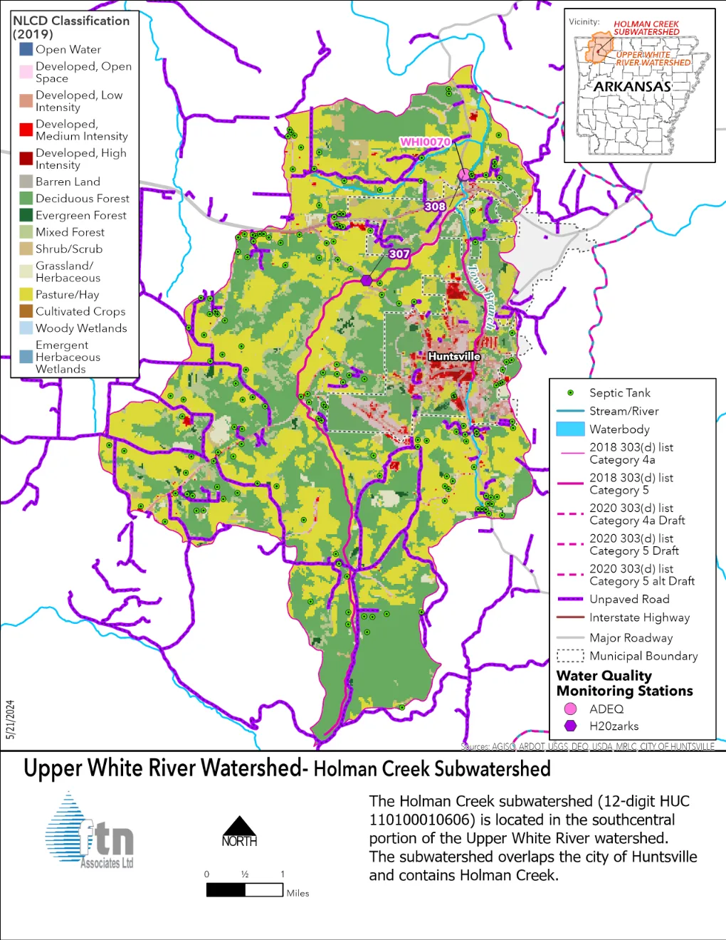
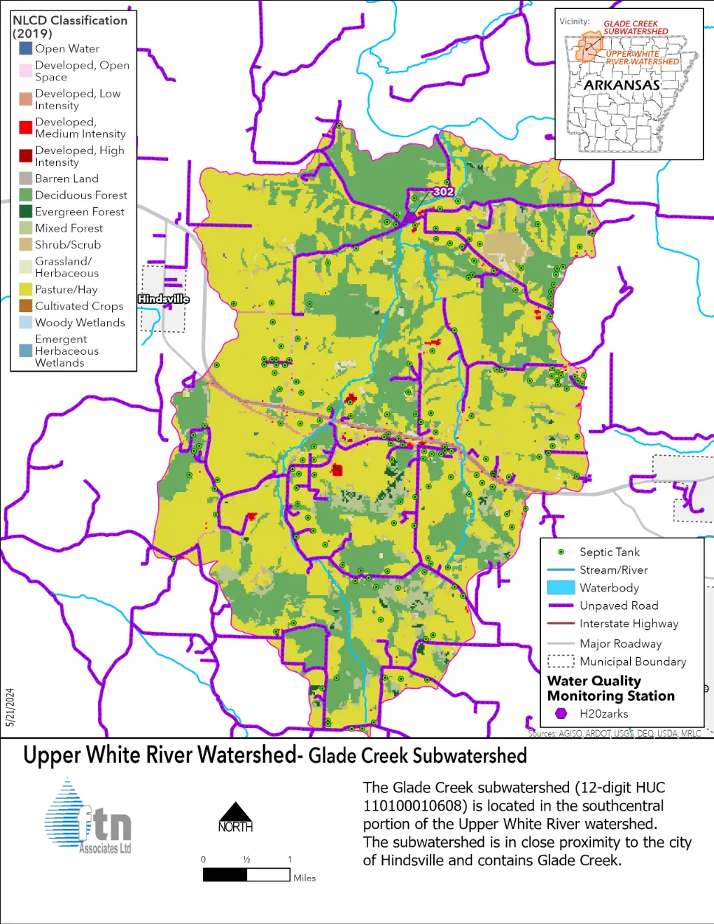
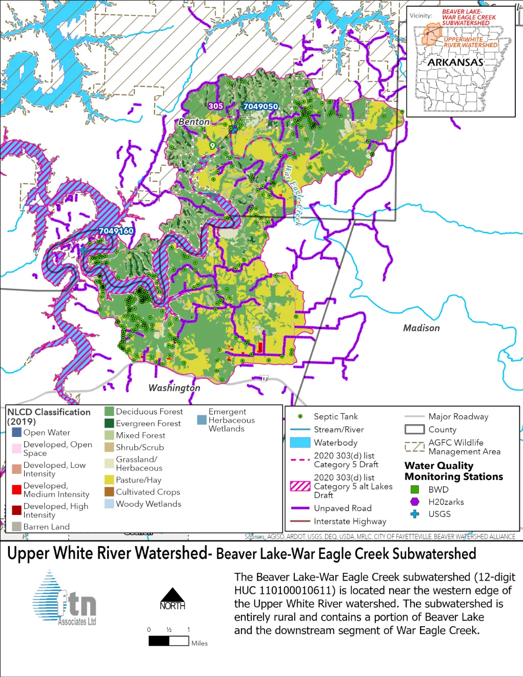
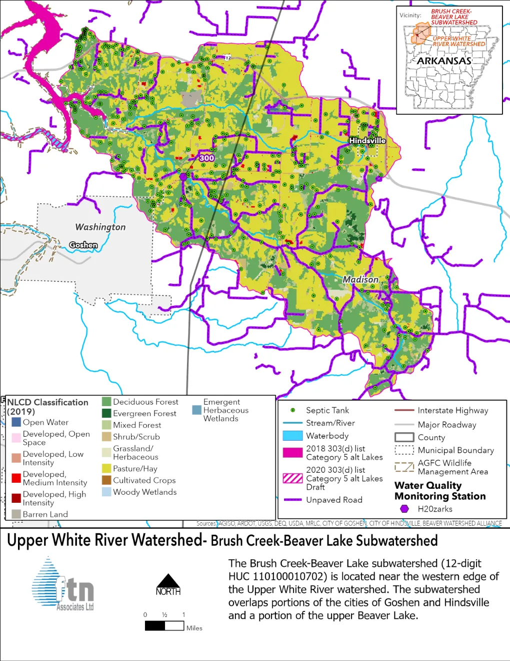
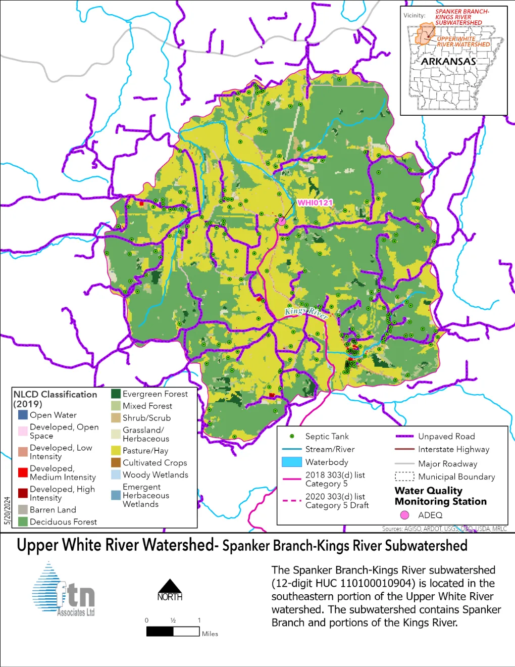
These 11 subwatersheds ranked highest for restoration activities based on water quality impairments, resource concerns, and nutrient and sediment loading. Click on the watershed name to see a pop-up of the land cover map.
